Cloud-Based Image Platform for Drone Pilot
KEY INFORMATION
Infocomm - Video/Image Processing
TECHNOLOGY OVERVIEW
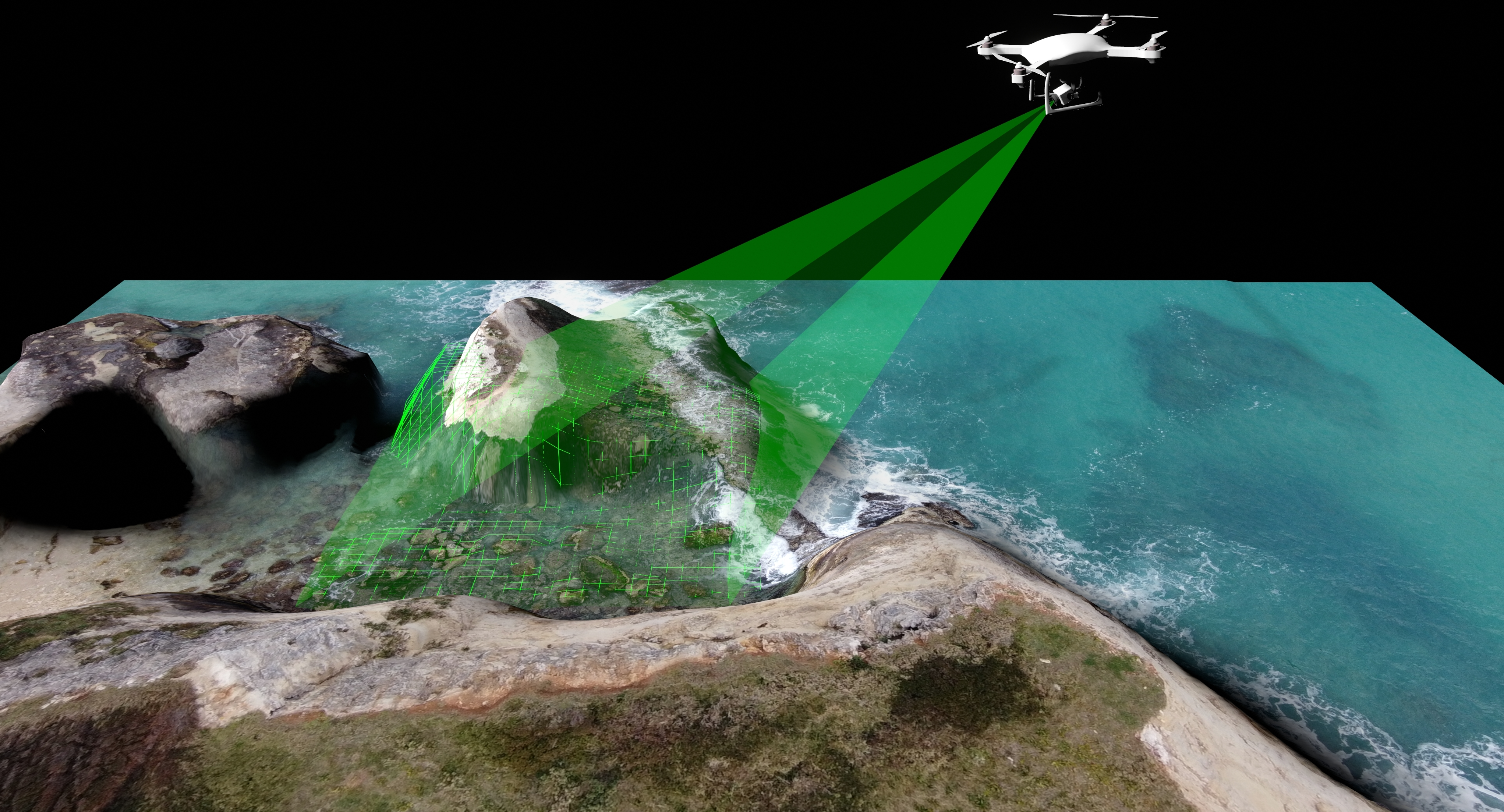
Traditionally, drone image processing has been associated with the need for high-end hardware, licensed software, and a deep understanding of photogrammetry. These requirements have often limited the broader utilization of drone-captured images. This technology empowers drone pilots by enabling them to process their images effortlessly on a cloud-based platform, resulting in the creation of map models that are ready for in-depth analysis. The cloud platform seamlessly handles all the hardware and software aspects, simplifying the previously intricate processing steps into user-friendly procedures. The solution serves to a wide range of users, from beginners who can generate maps with just a few clicks to experts who can conduct advanced analysis without having to switch to other software tools. Furthermore, the technology offers seamless integration with a company's existing information system, ensuring data security and customization to align with the company's workflow.
TECHNOLOGY FEATURES & SPECIFICATIONS
The technology is a cloud-based platform designed for processing aerial photography and generating a variety of output files, including orthophotos, surface models, point clouds, and textured models. What sets this platform apart is its powerful Geographic Information System (GIS) capabilities, which enable users to analyze and manage geo-spatial data directly on the map in an interactive manner, alongside the drone imagery. The map can be visualized in both 2D and 3D views, offering different perspectives for the data. Additionally, an integrated timeline feature allows users to track changes in their study area over time. The platform also offers handy tools like distance and area measurement, as well as volume calculations for any user’s study area. For advanced users, the platform provides additional features such as the ability to import ground control points, create elevation profiles, and generate contour maps.
POTENTIAL APPLICATIONS
This technology has a broad spectrum of applications in drone surveying. It empowers novice drone pilots to quickly generate their own maps. In precision agriculture, it serves as a valuable tool for monitoring plant health and growth, supporting smarter farming practices. It plays a pivotal role in mining and construction, simplifying tasks like site surveying, planning, monitoring, and inspections, including stockpile and volume calculations and elevation profile assessments. Moreover, this technology seamlessly integrates as a drone image processing engine into existing systems. This technology allows users to focus on their specific expertise without the need to worry about the complexities of drone image processing.
Market Trends & Opportunities
In 2022, the worldwide drone market was valued at approximately US$ 8.15 billion, and it is projected to grow at CAGR of 28.6% until 2030. With the increasing demand for drones, they are becoming commonplace gadgets with diverse applications. The need to create maps and models from drone-captured images for further analysis or decision support is a critical aspect of utilizing drone technology effectively.
Unique Value Proposition
This cloud-based platform technology enables users to easily process drone images, ensuring fast processing and delivering high-quality results, maximizing the benefits of their drone imagery.