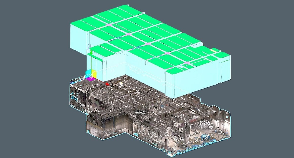
Digital Twin Platform for Quick Conversion of Point Cloud Data to BIM

KEY INFORMATION
Infocomm - Smart Cities
TECHNOLOGY OVERVIEW
3D scanning by employing technologies like LiDAR, laser scans, TOF cameras and photogrammetry is an essential step in the process of making digital twins for the construction and built space sectors. This data is then meticulously processed, often manually, to form the 3D models for integration with Building Information Modeling (BIM) platforms and creation of accurate digital twins. The 3D models, by themselves or in conjunction with the realised Digital Twin, also help in different planning and monitoring tasks during the entire lifecycle of a building from construction to maintenance.
Obtaining the 3D cloud data from scanning and its conversion to a model is an involved process. The technology presented here eases both these processes by providing diverse options for scanning and enabling AI assisted conversion of the data obtained to a 3D model capable of being used with BIM.
TECHNOLOGY FEATURES & SPECIFICATIONS
The technology is compatible with multiple third party scanning solutions and also provides some native options -
- - mm level one shot scan using stationary laser scanner with a scan time of a few minutes.
- - cm level mobile LiDAR based scan.
- - cm level TOF flight based fast scanning.
BIM conversion time is dependent on the kind of scan perfomed. For benchmarking, a test done using THETA and BLK2Go where BLK2Go was used to walk around and scan the site while THETA was used to take necessary pictures, required conversion time of ~10 days including manual intervention, for a unit 2500 sqm in size at LOD 100.
A further scanning option, using a handheld scanner requiring scans 5m apart and with a scan time of 1 second is also planned. This aims to remove the need of specialized personnel to conduct the scans. The solution also provides a model hosting option with GUI which gets automatically updated with new scan data for the same location regardless of the technology used. The previous data is still preserved and is available for review.
POTENTIAL APPLICATIONS
Possible applications for the solution include -
- - Faster and more accurate site surveys with lesser manpower requirement.
- - Identification of available space at planned construction site and simulation of delivery routes, assesment of safety and workability.
- - Progress monitoring by using data in comparison to BIM along with assessing material requirements.
- - Intuitive management analysis and reduction of building lifecycle costs by monitoring parameters like human flow, energy requirements, equipment use amongst others. (Digital Twin)
- - Simulation of processes and optimization of production line efficiency.
Unique Value Proposition
The technology uses AI to replace manual alignment of point cloud data and generate spacial linkages automatically thus saving substantial amount of time over current processes. The technology also provides option for an end to end solution encompassing scanning, data processing, digital twin generation and utilization. The generated results can also be hosted on a web platform which allows extension of use cases such as additional AI based solutions by third party collaborators.
